Community articles — Two-column
Recent
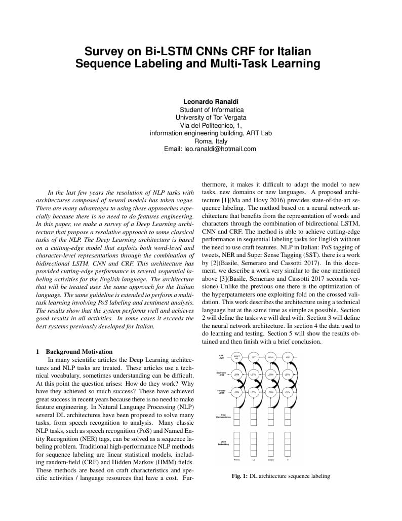
In the last few years the resolution of NLP tasks with architectures composed of neural models has taken vogue. There are many advantages to using these approaches especially because there is no need to do features engineering. In this paper, we make a survey of a Deep Learning architecture that propose a resolutive approach to some classical tasks of the NLP. The Deep Learning architecture is based on a cutting-edge model that exploits both word-level and character-level representations through the combination of bidirectional LSTM, CNN and CRF. This architecture has provided cutting-edge performance in several sequential labeling activities for the English language. The architecture that will be treated uses the same approach for the Italian language. The same guideline is extended to perform a multi-task learning involving PoS labeling and sentiment analysis. The results show that the system performs well and achieves good results in all activities. In some cases it exceeds the best systems previously developed for Italian.
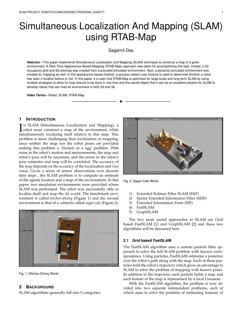
This paper implements Simultaneous Localization and Mapping (SLAM) technique to construct a map of a given environment. A Real Time Appearance Based Mapping (RTAB-Map) approach was taken for accomplishing this task. Initially, a 2d occupancy grid and 3d octomap was created from a provided simulated environment. Next, a personal simulated environment was created for mapping as well. In this appearance based method, a process called Loop Closure is used to determine whether a robot has seen a location before or not. In this paper, it is seen that RTAB-Map is optimized for large scale and long term SLAM by using multiple strategies to allow for loop closure to be done in real time and the results depict that it can be an excellent solution for SLAM to develop robots that can map an environment in both 2d and 3d.
Geometría Analítica
A study tool. Equations are mostly listed without a description of what they represent. Topics are detailed based on problems. Usage: To prepare for the Calculus BC exam, go through topics one at a time and mentally describe the problem, process, and equations involved. If you get stuck - look up the answer and start again from the top. When you can get through the entire sheet - you're ready! Do the same with the equation list - describing exactly what type of problems you might need the equation for. Do not use notes in conjunction with the review sheet. Look up the answer - close the book and start again! You can thank me later.
A new algorithm can speed up searching anything as a generalization of B/R-Trees
Sjabloon Kampvoorbereiding volgens richtlijnen Scouts en Gidsen Vlaanderen
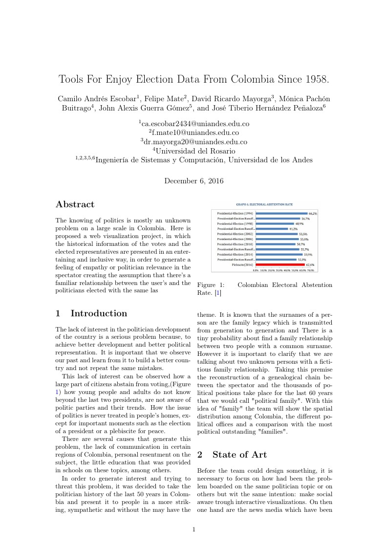
The knowing of politics is mostly an unknown problem on a large scale in Colombia. Here is proposed a web visualization project, in which the historical information of the votes and the elected representatives are presented in an entertaining and inclusive way, in order to generate a feeling of empathy or politician relevance in the spectator creating the assumption that there's a familiar relationship
Visualization is a descriptive way to ensure the audience attention and to make people better understand the content of a given topic. Nowadays, in the world of science and technology, visualization has become a necessity. However, it is a huge challenge to visualize varying amounts of data in a static or dynamic form. In this paper we describe the role, value and importance of visualization in maths and science. In particular, we are going to explain in details the benefits and shortages of visualization in three main domains: Mathematics, Programming and Big Data. Moreover, we will show the future challenges of visualization and our perspective how to better approach and face with the recent problems through technical solutions.
This article proposes to obtain a statistical model of the daily peak electricity load of a household located in Austin-TX,USA. The Box-Jenkins methodology was followed to obtain the best fit for the time-series. Four models provided a good fit: ARIMA(0,1,2), ARIMA(1,1,2), SARIMA(0,1,2)(0,1,1) and SARIMA(1,1,2)(0,1,1). The model with the highest Akaike Information Criteria was the ARIMA(1,2,2). However, the model with the highest forecast accuracy was the SARIMA(1,1,2)(0,1,1), which obtained an RMSE of 0.296 and a MAPE Of 15.00.
\begin
Discover why over 25 million people worldwide trust Overleaf with their work.